Sea fret, snow and floods: North Yorkshire's weather turns and how to plan around them
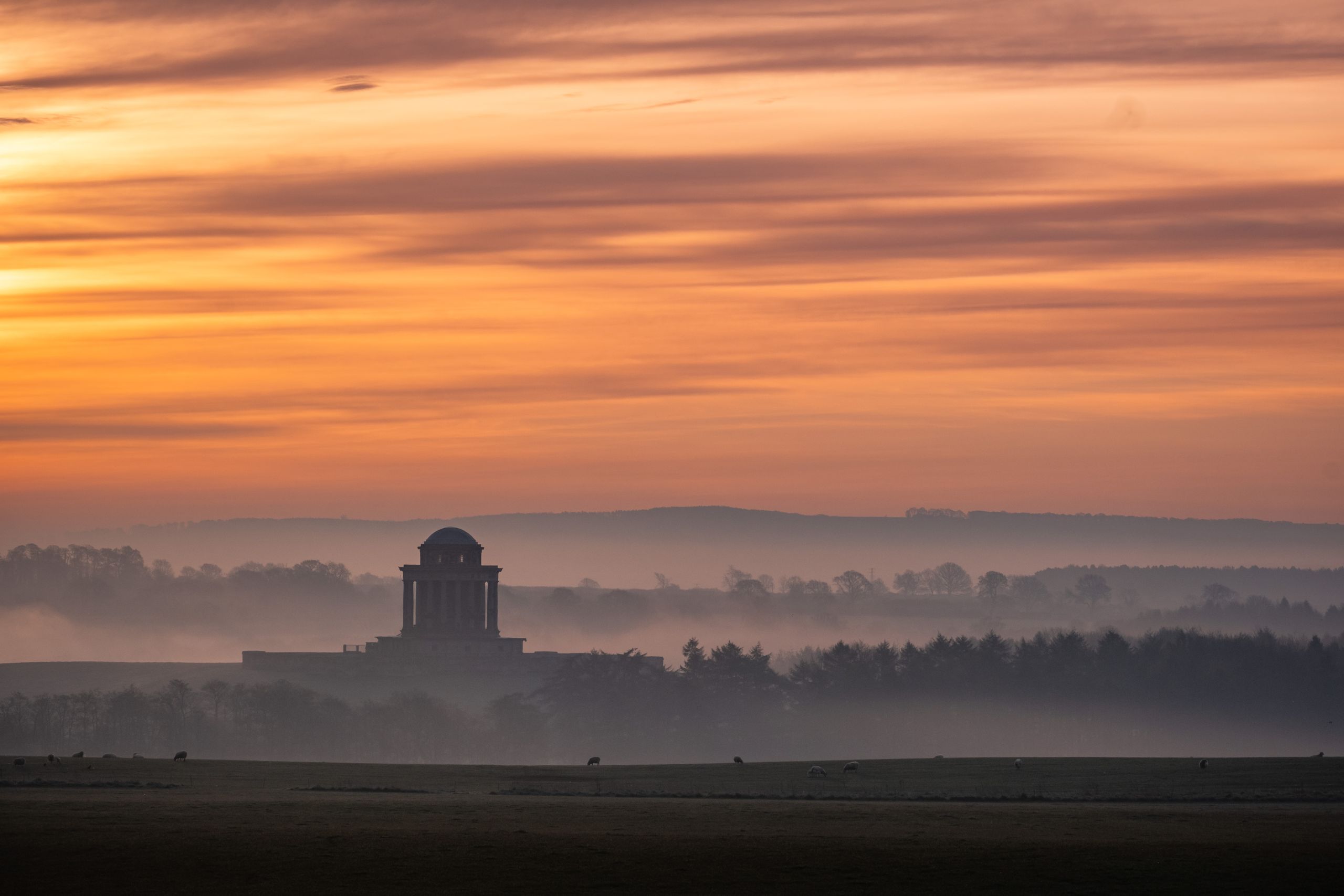 Cold sea mist rolling over a Yorkshire clifftop while inland fields stay in sunshine
The coast can sit at 14°C in fog while York bakes at 24°C twenty miles inland — one of four weather turns that decide whether a trip here works.
One county, three climates
Treat North Yorkshire as three weather zones and everything else makes sense. The coast from Filey to Whitby is cooler in summer, milder in winter, windier all year and prone to sea fog. The Vale of York, running from Selby through York and Northallerton, is the dry, warm, sheltered middle: roughly 600-650mm of rain a year, July highs around 21-22°C, and the county's best chance of a hot day. The western fells — Ingleton, Settle, upper Ribblesdale, the head of Wensleydale — take three times the rain, several degrees colder on the tops, and hold snow when the Vale sees none.
The practical use of this is substitution. If your plan is failing where you are, the alternative is usually 20-30 miles away and in a different zone. Fog on the coast means sunshine at Pickering or Castle Howard. Rain in Ribblesdale often means a dry afternoon at Ripon or Boroughbridge. Snow that closes Blakey Ridge rarely touches Malton. Build every itinerary with a plan B that lives in another zone, and you convert most bad-weather days from a write-off into a change of direction.
Sea fret: the turn that ruins beach weeks
The fret, or haar, is cold coastal fog formed when mild air passes over a North Sea that is still only 8-12°C in spring. It is most common from April through July, arrives on an easterly or north-easterly, and can drop the seafront from 20°C to 13°C in twenty minutes. Whitby, Scarborough, Filey and Robin Hood's Bay all get it; Robin Hood's Bay, hemmed in by cliffs, feels it worst. It is not rain and it is not all-day — it typically burns back offshore by early afternoon on a sunny day, or clings for 48 hours if the wind stays east.
The response is simple and almost always works: drive inland. Fifteen miles takes you out of it. From Whitby, that means the moor road to Goathland or the A169 to Pickering. From Scarborough, Dalby Forest, Thornton-le-Dale or Castle Howard. From Filey, Malton in twenty-five minutes. Check the wind direction rather than the forecast temperature before you commit to a beach day — an easterly in June on the Yorkshire coast is a warning sign. And book a coastal room with an inland day or two built in rather than a five-day seafront plan with no escape.
Summer heat, and where it is bearable
The Vale of York genuinely gets hot. Heat spells push York past 30°C every few summers, and the medieval centre, with narrow streets, dark stone and little shade, becomes hard work between noon and four. There is no air conditioning in most of the older hotels inside the bar walls, and top-floor rooms in Georgian buildings hold heat overnight. If you are heat-sensitive and travelling in July or August, ask specifically about cooling and floor level when you book, and plan the Minster and the Shambles for early morning rather than mid-afternoon.
The cool options are the ones the fret makes miserable in spring and delightful in a heatwave: the coast, where an onshore breeze keeps Whitby and Filey five to eight degrees below York, and the wooded gorges — the Ingleton Waterfalls Trail, Hackfall Wood near Masham, the Strid woods at Bolton Abbey. Rivers are the other answer, and the Wharfe at Burnsall and Appletreewick fills with swimmers on a hot Sunday. Do not swim at the Strid: the narrow section of the Wharfe there is genuinely lethal and has killed people. That is one warning worth taking literally.
The autumn and winter flood calendar
York floods, and it does so on a schedule that is roughly November to February. The Ouse collects water from the Swale, Ure, Nidd and Wharfe, all draining the Dales, and it peaks a day or two after heavy rain on the fells — which means the river can rise in York under a blue sky. The visible effects are the riverside walkways under water, King's Staith and Queen's Staith flooded with pub doorways sandbagged, and the Foss Barrier operating at the confluence. Hotels above the bank are unaffected; riverside bars and some car parks are not.
It is rarely a reason to cancel a trip, but it is a reason to check. Look at the flood warnings before travelling in winter, avoid booking a riverside ground-floor room in January, and expect river cruises to be suspended when levels are high. Elsewhere the pinch points are the Wharfe around Tadcaster, the Swale near Catterick and low-lying roads across the Vale of York, which close for a day at a time. In the Dales, spate turns Aysgarth Falls, Hardraw Force and the Ingleton gorge into the best version of themselves — the compensation for a wet week.
Snow, and the roads that shut first
Snow in North Yorkshire is an altitude story. The Vale of York sees a handful of lying-snow days a year; above 300 metres it is a different county. The roads that go first are predictable: Sutton Bank on the A170 above Thirsk, a one-in-four climb that is closed to caravans year-round and shuts in ice; Blue Bank on the A169 above Sleights on the Whitby-Pickering road; the moor road on the A171 between Whitby and Guisborough; Buttertubs and Fleet Moss in the Dales; and the lane to the Tan Hill Inn, which is cut off most winters. Trans-Pennine routes west of the county add their own delays.
Plan accordingly rather than pessimistically. Gritting priority routes cover the main A roads and they usually stay open, so a winter itinerary built on the A1(M), A19, A64, A65 and A684 is robust. Trouble comes from satnavs routing you over a moor to save eight minutes, from arriving after dark on an unfenced road with sheep on it, and from summer tyres on a one-in-four bank. Keep a shovel, a blanket, a torch and a full tank in December and January, and check the roads with the highways authority and traffic services on the morning.
Wind, and what it does to the coast
The coast is exposed and the wind is the most underestimated variable there. Autumn and winter north-easterlies drive big seas into Whitby harbour and over the piers at Scarborough, and Filey Brigg becomes genuinely dangerous. Storm days are spectacular from the West Cliff at Whitby or the Spa at Scarborough, but they also cancel boat trips, close the pier walks, shut the funiculars and make the cliff paths on the Cleveland Way unpleasant to the point of pointlessness. Any trip built around a sea-fishing charter or a harbour cruise should carry a flexible day.
There is a second, quieter effect: wind decides whether a beach day works even in July. Filey and Scarborough's South Bay are relatively sheltered in a northerly; Whitby's beach at Sandsend is exposed. Robin Hood's Bay is at its best at low tide regardless, and checking the tide table matters more there than the forecast — at high tide the beach essentially disappears and the scramble down from the village leads nowhere. Tide times are published locally and by the harbour authorities and should be part of planning any Yorkshire coast day.
Booking around the weather
Between November and March, pay the £10-15 premium for a refundable rate. The chance you will want to move a Dales weekend because of snow or a coastal weekend because of a storm is high enough that flexibility is cheaper than the alternative. Between June and August, take the non-refundable rate: the risk is that the room sells out, not that you cancel, and the saving is real. In April and May, the fret makes coastal bookings the one case where flexibility is still worth buying, particularly if the whole point of the trip is a beach.
Choose the base with the weather in mind too. A coastal town with nothing indoor is a poor bet in a wet week; Whitby and Scarborough both have enough museums, arcades, abbeys and swimming to fill two rainy days, while Robin Hood's Bay and Staithes do not. Inland, York, Harrogate and Skipton are the wet-weather-proof bases. And if you have five nights, split them across two zones — three on the coast and two inland — rather than gambling all of them on one microclimate behaving.
What to pack, month by rough month
Year-round: waterproof jacket and boots that cope with mud, because the field paths in the Vale and the tracks in the Dales are wet nine months of the year. April to July, add a warm layer for the coast even if the forecast is 22°C — the fret means a jumper on a beach in June is normal rather than eccentric. July and August, add sun protection and remember the Dales have almost no shade above the valley floor. September and October are the most forgiving months here: warm ground, settled spells, low midges, and colour in the woods around Bolton Abbey and Nidderdale.
November to March, add hat, gloves, a headtorch and, if driving in the hills, the shovel and blanket. Daylight is the hidden hazard: around the solstice you have from just after eight until about a quarter to four, and a Dales or Moors walk that starts at eleven is a walk that finishes in the dark. Finally, check tide tables for any coastal walk under the cliffs, particularly at Robin Hood's Bay and between Whitby and Sandsend, where people get cut off every year. Verify current forecasts, warnings and tide times with the official sources on the day.
Before you book
The questions people ask about York, answered with this month’s numbers.
Not all summer, but sea fret is common from April to July on an easterly wind and can hold the seafront at 13-15°C while York is 24°C. It often clears by early afternoon. The fix is to drive fifteen to twenty miles inland to Pickering, Dalby Forest or Castle Howard rather than waiting it out.
Only if you have booked a riverside ground-floor room or planned a river cruise. The Ouse rises from November to February, a day or two after Dales rainfall, flooding the staith walkways and some car parks. The city centre and the Minster are unaffected. Check flood warnings before you travel.
The Vale of York, from Selby through York to Northallerton, with roughly 600-650mm of rain a year and July highs around 21-22°C. The western fells around Ingleton and upper Ribblesdale take about three times the rainfall and are several degrees colder on the tops.
September and early October are the county's most reliable stretch: warm ground, fewer fret days than early summer, autumn colour in the woods at Bolton Abbey and Nidderdale, and rooms £30-50 cheaper than August once schools return. Late May is the spring equivalent, with long evenings and everything open.